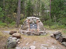
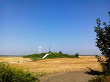
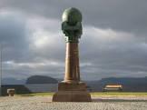
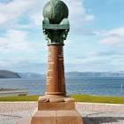
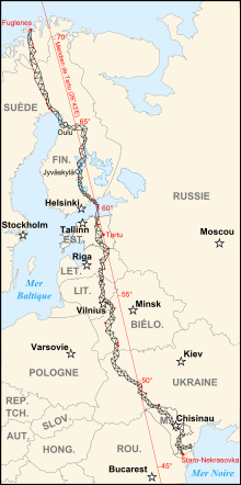
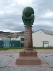
The Struve Arc is a series of triangulated lines from Hammerfest, Norway to the Black Sea, passing through 10 countries and covering a length of more than 2,820 km. These are the result of a survey carried out between 1816 and 1855 by astronomer Friedrich Georg Wilhelm Struve, which was the first accurate measurement of a long segment of the meridian. This helped to determine the exact size and shape of the Earth and marked an important step in the development of Earth science and topographic mapping. It is an extraordinary example of scientific cooperation between scientists from different countries and cooperation between monarchs for the sake of science. The original arc consisted of 258 main triangles and 265 main stations. The listed sites include 34 original stations, which are variously marked by rock drill holes, iron crosses, stone tablets or constructed obelisks.
| country |
Sweden |
| country |
Moldova |
| country |
Russia |
| country |
Lithuania |
| country |
Josef Kirpal |
| image |
http://commons.wikimedia.org/wiki/Special:FilePath/Hammerfest%20Meridianstein.jpg |
| located in the administrative territorial entity |
Category:Views of Salzburg |
| located in the administrative territorial entity |
Ylitornio |
| executive body |
Struve Geodetic Arc |
| location of creation |
Struve Geodetic Arc |
| Wolfram Language entity code |
Entity["HistoricalSite", "StruveGeodeticArc::ff4pz"] |
| number of rooms |
viaf-308249415 |
| office held by head of the organization |
http://g.co/kg/m/06zjs7 |
| Commons category |
Struve Geodetic Arc |
| has part |
circa |
| has part |
Palazzo del Capitaniato |
| has part |
Pure Land Buddhism |
| has part |
Aavasaksa |
| has part |
São Torcato |
| has part |
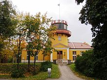
University of Tartu Old Observatory |
| has part |
Leskovichi geodetic point |
| has part |
São Manços e São Vicente do Pigeiro |
| coordinate location |
Point(25.649444444 52.289444444) |
| cultural properties of Belarus reference number |
410Д000001 |
| Commons gallery |
Struve Geodetic Arc |
| page banner |
http://commons.wikimedia.org/wiki/Special:FilePath/Struve%20Geodetic%20Arc%20in%20Felshtyn%20banner.jpg |
| start time |
2005-01-01T00:00:00Z |
| heritage designation |
cultural property of Belarus |
| World Heritage criteria |
World Heritage selection criterion (ii) |
| World Heritage criteria |
World Heritage selection criterion (vi) |
| Wolfram Language entity code |
Entity["HistoricalSite", "StruveGeodeticArc::ff4pz"] |
| on focus list of Wikimedia project |
Eesti 1001 |