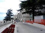
The Historic Centre of San Marino and Mount Titano covers an area of 55 hectares and includes Mount Titano and the historic centre of the city, dating back to the founding of the Republic as a city-state in the 13th century. San Marino is listed as a testimony to the continuity of a free republic since the Middle Ages. The listed city centre includes defensive towers, walls, gates and fortresses, as well as the 19th-century neoclassical cathedral, 14th- and 16th-century monasteries, the 19th-century Palazzo Comunale and the 18th-century Teatro Titano. The property represents a historic centre that is still inhabited and has preserved all its institutional functions. Due to its location on top of Mount Titano, it has not been affected by the urban transformations that have taken place from the advent of the industrial age to the present day.
| Dewey Decimal Classification |
2--4549 |
| U.S. National Archives Identifier |
10044714 |
| official name |
Città di San Marino |
| category for people who died here |
Belize |
| native label |
Città di San Marino |
| UN/LOCODE |
SMSAI |
| area |
7.09 |
| collage image |
http://commons.wikimedia.org/wiki/Special:FilePath/Collage%20San%20Marino.jpg |
| geoshape |
http://commons.wikimedia.org/data/main/Data:San+Marino/San+Marino.map |
| named as |
San Marino |
| uses |
4263384-9 |
| image |
http://commons.wikimedia.org/wiki/Special:FilePath/Citt%C3%A0%20di%20San%20Marino%202019.jpg |
| instance of |
border town |
| instance of |
municipality of San Marino |
| flag image |
http://commons.wikimedia.org/wiki/Special:FilePath/Flag%20of%20City%20of%20San%20Marino.png |
| direction relative to location |
northwest |
| shares border with |
San Leo |
| coat of arms image |
http://commons.wikimedia.org/wiki/Special:FilePath/Citt%C3%A0%20di%20San%20Marino.JPG |
| named after |
Saint Marinus |
| start time |
1968-01-01T00:00:00Z |
| twinned administrative body |
Sarek National Park |
| ISNI |
0000 0004 0638 851X |
| locator map image |
http://commons.wikimedia.org/wiki/Special:FilePath/City%20of%20San%20Marino%20in%20San%20Marino%20%28%2Bpop%20areas%29.svg |
| Danish urban area code |
SM-07 |
| executive body |
San Marino (city) |
| location of creation |
San Marino |
| U.S. National Archives Identifier |
10044714 |
| IPA transcription |
3533352 |
| office held by head of the organization |
http://g.co/kg/m/024k9d |
| postal code |
RSM-47890 |
| ISO 3166-2 code |
SM-07 |
| part of |
San Marino Historic Centre and Mount Titano |
| Commons category |
San Marino (city) |
| licence plate code |
RSM |
| inception |
0301-01-01T00:00:00Z |
| coordinate location |
Point(12.44845 43.932011111) |
| official website |
http://www.sanmarinosite.com/castelli/sanmarino/ |
| FIPS 10-4 (countries and regions) |
SM07 |
| Commons gallery |
San Marino |
| population |
4128 |
| point in time |
2013-01-01T00:00:00Z |
| population |
4040 |
| point in time |
2018-01-01T00:00:00Z |
| elevation above sea level |
749 |
| maximum value |
749 |
| minimum value |
501 |
| twinned administrative body |
San Leo |
| start time |
1995-01-01T00:00:00Z |