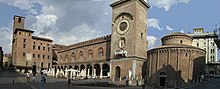
Mantua and Sabbioneta in the Po Valley in northern Italy represent two aspects of Renaissance urban planning: Mantua shows the renewal and expansion of an existing city, while Sabbioneta, 30 km away, represents the implementation of the period's theories on planning an ideal city. Mantua's layout is generally irregular, and the regular part shows different stages of development since the Roman period, including many medieval buildings, including an 11th-century rotunda and a Baroque theater. Sabbioneta was built in the second half of the 16th century under the rule of one man, Vespasiano Gonzaga Colonna, and can be described as a city of a single period, with a right-angled grid layout. Both cities bear extraordinary testimony to the urban, architectural and artistic realization of the Renaissance, and are linked by the vision and actions of the ruling Gonzaga family. The two towns are important for the value of their architecture and for their prominent role in the dissemination of Renaissance culture. The Renaissance ideals promoted by the Gonzaga family are reflected in the morphology and architecture of the towns.
| uses |
4114978-6 |
| image |
http://commons.wikimedia.org/wiki/Special:FilePath/Mantova%20Skyline.jpg |
| instance of |
comune of Italy |
| shares border with |
San Giorgio Bigarello |
| coat of arms image |
http://commons.wikimedia.org/wiki/Special:FilePath/Mantova-Stemma.svg |
| twinned administrative body |
Category:Karlskrona |
| twinned administrative body |
Casale Monferrato |
| twinned administrative body |
Giulianova |
| twinned administrative body |
Guizhou |
| twinned administrative body |
Weingarten |
| twinned administrative body |
Brixen |
| twinned administrative body |
New Gate |
| locator map image |
http://commons.wikimedia.org/wiki/Special:FilePath/Map%20of%20comune%20of%20Mantua%20%28province%20of%20Mantua%2C%20region%20Lombardy%2C%20Italy%29.svg |
| executive body |
Mantua |
| location of creation |
Mantova |
| U.S. National Archives Identifier |
10044644 |
| date of death |
Point(10.7229025 45.1666442) |
| start time |
1868-01-01T00:00:00Z |
| official name |
Mantova |
| native label |
Mantova |
| UN/LOCODE |
ITMAN |
| elevation above sea level |
19 |
| area |
175 |
| area |
63 |
| start time |
2020-09-01T00:00:00Z |
| panoramic view |
http://commons.wikimedia.org/wiki/Special:FilePath/Mantova-Panorama.jpg |
| category for maps |
Category:Maps of Mantua |
| BHCL UUID |
c7d27abe-8493-4229-a46a-2f11fed4a371 |
| IPA transcription |
2183705 |
| McCune-Reischauer romanization |
mantova |
| DOI |
M/Mantua |
| office held by head of the organization |
http://g.co/kg/m/0d8zt |
| postal code |
46100 |
| Commons category |
Mantua |
| licence plate code |
MN |
| valid in period |
standard time |
| pronunciation audio |
http://commons.wikimedia.org/wiki/Special:FilePath/It-Mantova.ogg |
| local dialing code |
0376 |
| coordinate location |
Point(10.791111111 45.156388888) |
| significant event |
Category:Agave Landscape and Ancient Industrial Facilities of Tequila |
| significant event |
Belfry of Aire-sur-la-Lys |
| Italian cadastre code |
E897 |
| official website |
http://www.comune.mantova.gov.it/ |
| Commons gallery |
Mantova |
| page banner |
http://commons.wikimedia.org/wiki/Special:FilePath/Mantova%20banner%202.JPG |
| described at URL |
https://guideturistichemantova.it |
| Dewey Decimal Classification |
2--45281 |
| U.S. National Archives Identifier |
10044644 |
| coordinates of northernmost point |
Point(10.7712475 45.1868312) |
| coordinates of southernmost point |
Point(10.8873729 45.1019574) |
| coordinates of easternmost point |
Point(10.9042759 45.1104884) |
| coordinates of westernmost point |
Point(10.7229025 45.1666442) |
| described by source |
Edinburgh to Aberdeen Line |
| described by source |
Amsterdam |
| country |
Cisalpine Republic |
| start time |
1801-02-16T00:00:00Z |
| end time |
1802-01-26T00:00:00Z |
| country |
Kingdom of Italy |
| start time |
1866-08-23T00:00:00Z |
| end time |
1946-01-01T00:00:00Z |
| start time |
1799-07-27T00:00:00Z |
| end time |
1801-02-16T00:00:00Z |
| start time |
1814-05-25T00:00:00Z |
| end time |
1866-08-22T00:00:00Z |
| country |
Marseille |
| start time |
1802-01-26T00:00:00Z |
| end time |
1805-03-17T00:00:00Z |
| start time |
1797-02-01T00:00:00Z |
| end time |
1799-07-26T00:00:00Z |
| start time |
1433-01-01T00:00:00Z |
| end time |
1530-01-01T00:00:00Z |
| start time |
1530-10-02T00:00:00Z |
| end time |
1708-07-05T00:00:00Z |
| start time |
1946-01-01T00:00:00Z |
| series ordinal |
1 |
| start time |
1708-07-05T00:00:00Z |
| end time |
1797-01-01T00:00:00Z |
| country |
Kingdom of Italy |
| start time |
1805-03-17T00:00:00Z |
| end time |
1814-05-25T00:00:00Z |
| twinned administrative body |
Oradea |
| start time |
2005-01-01T00:00:00Z |
| start time |
1797-01-01T00:00:00Z |
| end time |
1814-01-01T00:00:00Z |
| start time |
1791-07-08T00:00:00Z |
| end time |
1797-02-03T00:00:00Z |
| start time |
1530-01-01T00:00:00Z |
| end time |
1786-01-01T00:00:00Z |
| start time |
1433-01-01T00:00:00Z |
| end time |
1530-01-01T00:00:00Z |
| heritage designation |
Category:Views of Pienza |
| start time |
2008-01-01T00:00:00Z |
| official name |
Mantua |
| area |
63.81 |
| point in time |
2011-10-09T00:00:00Z |
| area |
1900 |
| applies to part |
buffer zone |
| Libris-URI |
https://libris.kb.se/khwzxrj34w1nwr6 |
| Libris-URI |
khwzxrj34w1nwr6 |
| described at URL |
https://guideturistichemantova.it/?lang=de |
| language of work or name |
German |
| population |
49308 |
| determination method |
demographic balance |
| point in time |
2017-01-01T00:00:00Z |
| population |
49409 |
| determination method |
demographic balance |
| point in time |
2018-01-01T00:00:00Z |
| population |
48103 |
| point in time |
2004-01-01T00:00:00Z |
| described by source |
The Nuttall Encyclopædia |
| stated as |
Mantua |
| start time |
1815-01-01T00:00:00Z |
| end time |
1868-01-01T00:00:00Z |
| start time |
1786-01-01T00:00:00Z |
| end time |
1791-07-08T00:00:00Z |