Lord Howe Island Group
World Heritage
Australia
🎧 Listen to Introduction
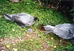
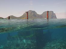
These islands are outstanding examples of isolated oceanic islands, created by volcanic activity more than 2,000 metres below the seafloor, with spectacular topography and home to numerous endemic species, especially birds.
# Volcanic activity
# Endemic species
# Isolated ocean island
# 2000 meters deep
# Spectacular terrain


 – Mount Lidgbird track.jpg)
 southeast of the main island.jpg)
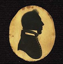
. A drawing made in May 1788 by Arthur Bowes Smyth who .jpg)

Poem of the heritage generated by AI
Intangible culture related to the heritage
China tourist attractions related to the heritage
World heritage related to the heritage
Show more related heritage
Information extracted from Wikidata
| coordinate location | Point(159.083333333 -31.55) |
| official website | http://www.lordhoweisland.info |
| Commons gallery | Lord Howe Island |
| page banner | http://commons.wikimedia.org/wiki/Special:FilePath/Lord%20Howe%20Island%20banner.jpg |
| native label | Lord Howe Island |
| length | 11 |
| elevation above sea level | 59 |
| area | 14.6 |
| width | 2 |
| geoshape | http://commons.wikimedia.org/data/main/Data:Australia/Lord+Howe+Island.map |
| category for maps | Category:Maps of Lord Howe Island |
| uses | 4321260-8 |
| country | Wet Tropics of Queensland - Component around Edmund Kennedy |
| instance of | island |
| located in the administrative territorial entity | Church of Chonchi |
| located in or next to body of water | Tasman Sea |
| locator map image | http://commons.wikimedia.org/wiki/Special:FilePath/Lord%20Howe%20Island.PNG |
| named as | Lord Howe Island (N.S.W.) |
| executive body | Lord Howe Island |
| location of creation | Lord Howe Island |
| male population | 1244331 |
| office held by head of the organization | http://g.co/kg/m/02m6g4 |
| postal code | 2898 |
| Commons category | Lord Howe Island |
| local dialing code | 0255 |
| local dialing code | 0265 |
| time of discovery or invention | 1788-02-17T00:00:00Z |
| population | 382 |
| determination method | Australian census 2016 |
| applies to part | state suburb |
| point in time | 2016-08-09T00:00:00Z |
| female population | 191 |
| determination method | Australian census 2016 |
| applies to part | state suburb |
| point in time | 2016-08-09T00:00:00Z |
| male population | 192 |
| determination method | Australian census 2016 |
| applies to part | state suburb |
| point in time | 2016-08-09T00:00:00Z |
| image | http://commons.wikimedia.org/wiki/Special:FilePath/LordHoweIslandFromKimsLookout.jpg |
| media legend | Lord Howe-øya. Utsikt fra Kim's Lookout mot fjellene Lidgbird og Gower |