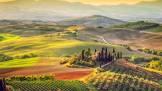
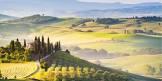
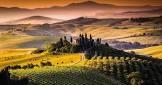
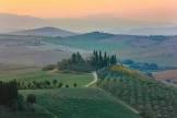
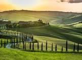
Val d'Orcia
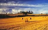
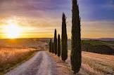
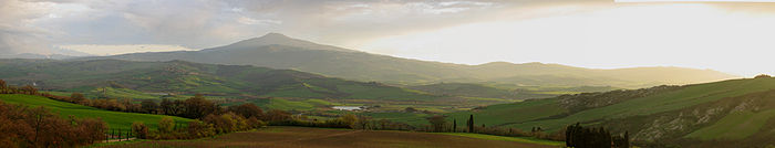
The landscape of the Val d'Orcia is part of Siena's agricultural hinterland, and when it was incorporated into the city-state's territory in the 14th and 15th centuries, it was redrawn and developed to reflect an idealized model of good governance and to create a pleasing picture. The unique aesthetic of the landscape, with flat chalk plains rising up to almost conical hills topped by fortifications, inspired many artists. Their images became models of the beauty of a well-managed agricultural landscape during the Renaissance. The inscriptions cover: agricultural and pastoral landscapes reflecting innovative land management systems; towns and villages; farmhouses; the Roman Via Francigena and its associated monasteries, inns, shrines, bridges, etc.

Poem of the heritage generated by AI
Intangible culture related to the heritage
China tourist attractions related to the heritage
World heritage related to the heritage
Information extracted from Wikidata
| Commons category | Val d'Orcia |
| coordinate location | Point(11.55 43.066666666) |
| official website | http://www.parcodellavaldorcia.com |
| topic's main category | Category:Val d'Orcia |
| Commons gallery | Val d'Orcia |
| page banner | http://commons.wikimedia.org/wiki/Special:FilePath/Val%20d%27Orcia%20banner.jpg |
| start time | 2004-01-01T00:00:00Z |
| World Heritage criteria | World Heritage selection criterion (vi) |
| World Heritage criteria | Larousse Encyclopedia online |
| mountain range | Natural and Cultural Heritage of the Ohrid region |
| uses | 4261729-7 |
| image | http://commons.wikimedia.org/wiki/Special:FilePath/Val%20d%27orcia%20-pienza.JPG |
| located in the administrative territorial entity | Province of Siena |
| located in or next to body of water | Dům dětí a mládeže Modřany |
| executive body | Val d'Orcia |
| location of creation | Val d'Orcia |
| office held by head of the organization | http://g.co/kg/m/0h5xk9 |